Daniel Boone Wilderness Trail
Homeplace Mountain Farm and Museum
Rt. 224, Gate City, Virginia
Website
Driving Directions
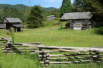
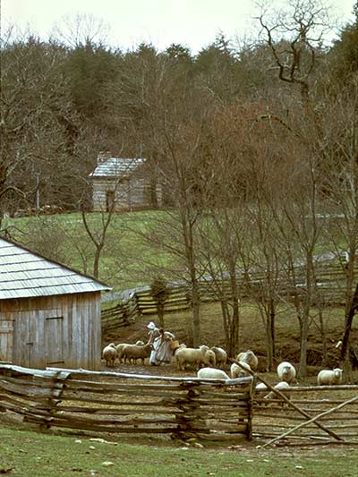
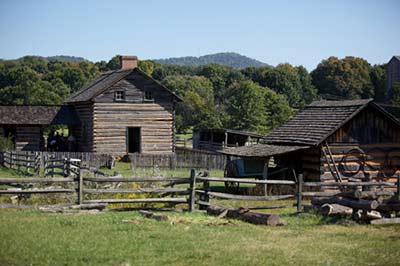
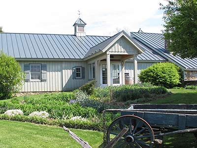
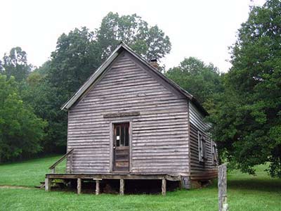
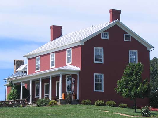
Scott County was formed by an act of the General Assembly on November 24, 1814, from parts of Washington, Lee, and Russell Counties, and was named for General Winfield Scott. This living history museum depicts an 1840s farmstead in the mountains of Southwest Virginia. The collection of authentic structures and artifacts has been assembled here from their original locations throughout Scott County.
Natural Tunnel State Park/Wilderness Road Blockhouse
1420 Natural Tunnel Parkway, Duffield, Virginia
Website
Driving Directions
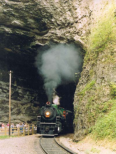
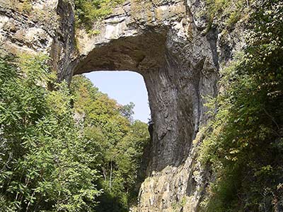
Natural Tunnel State Park is named after the one-million-year-old cave which runs under Purchase Ridge, allowing Stock Creek to go in one side and out the other. A railroad has taken advantage of this natural passage to follow the path of the creek, and daily coal trains can be seen roaring through the tunnel. The Wilderness Road Blockhouse erected at Natural Tunnel State Park in 2003 is typical of the blockhouses that were manned by the Holston Militia during the frontier conflict between the Indians and settlers.
Wilderness Road State Park/Martin’s Station Living History Park
8051 Wilderness Road, Ewing, Virginia
Website
Driving Directions
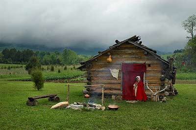
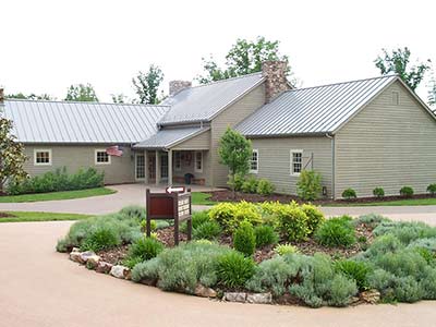
A tract in the Powell Valley was originally settled by Joseph Martin, who arrived in March of 1769 after a difficult journey to claim 21,000 acres as the first settler on land granted to the Loyal Land Company. Boone found Martin already in place at his station when he made the trip into Kentucky in the spring of 1775. Wilderness Road State Park features a reconstruction of Martin’s Station and a visitor center located in the 1877 Ely House.
Cumberland Gap National Historical Park/Daniel Boone Visitor Center/White Rocks Overlook
91 Bartlett Park Road, Middlesboro, Kentucky
Website
Driving Directions
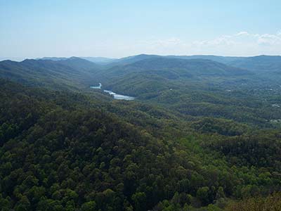
Cumberland Gap was the only easily accessible pass through the Alleghany Mountains. Prior to 1750, it was used by Indians moving from area to area in trading, hunting, or war parties. Daniel Boone was commissioned to open a trail through the gap, known as “Boone’ s Trace.” During the 1790s a mass of immigrants passed through Cumberland Gap at the rate of nearly 100 per day, looking for available land in the west. The Daniel Boone Visitor Center houses a museum, interpretive films, and handmade crafts from the region.
Carolina Road
Booker T. Washington National Monument
12130 Booker T Washington Highway, Hardy, Virginia
Website
Driving Directions
Booker T. Washington National Monument commemorates the birthplace of America’s most prominent African American educator and orator of the late nineteenth and early twentieth centuries. The property evokes an 1850s middle class tobacco farm, representative of Booker T. Washington’s childhood at the farm owned by the prosperous Burroughs family. He was born in 1856 to their enslaved cook, Jane, and lived on the farm throughout the Civil War. After the Civil War, Washington became the first principal of Tuskegee Normal and Industrial School. As an adviser, author and orator, he became the most influential African-American of his era.
Franklin County Historical Society Museum
508 Franklin Street, Rocky Mount, Virginia
Website
Driving Directions
Rocky Mount was designated as the seat of Franklin County, Virginia, when the county was formed in 1786. The first court sessions were held in the home of James Callaway, the proprietor of the 1770 Washington Iron Furnace. A log courthouse was built at the intersection of Court and Main streets in the same year. The Franklin County Historical Society operates a history museum and research library for family history research. Franklin County court, probate, and land records, also available at the nearby Franklin County Courthouse, are an important source for family historians.
Blue Ridge Institute and Museum/Blue Ridge Farm Museum
Ferrum College, 20 Museum Drive, Ferrum, Virginia
Website
Driving Directions
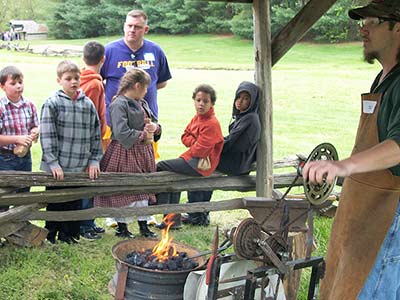
Ferrum College opened the Blue Ridge Institute and Museum in the early 1970s to document and interpret the folk heritage of the Blue Ridge area. The museum has an important collection of furniture, textiles, and decorative arts from the region. The institute presents the annual Blue Ridge Folklife Festival, the state’s largest celebration of regional folkways, and the Blue Ridge Farm Museum, a living history farmstead demonstrating early rural life, including cooking, farming, crafts, and historic animal breeds.
Bassett Historical Center
3964 Fairystone Park Highway, Bassett, Virginia
Website
Driving Directions
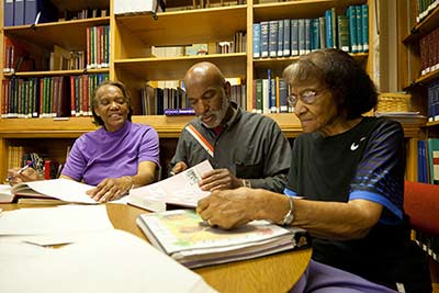
The Bassett Historical Center contains an extensive collection of genealogical research and local history research for both Henry and Patrick counties and Martinsville. The Center currently houses family files, local history files, genealogy books, early African-American materials, and the histories of local industries. It is regularly open for visitors pursuing family history research.
Martinsville-Henry County Heritage Center
1 East Main Street, Martinsville, Virginia
Website
Driving Directions
Martinsville was laid out in 1791 on the land of tobacco planter George Hairston as the seat of Henry County. It was named in honor of Joseph Martin, a legendary frontiersman, Indian trader and hero of the American Revolution. The original log courthouse was replaced by a brick structure in 1824. This was remodeled in 1929 and, since 2011, houses the Martinsville-Henry County Heritage Center & Museum. The museum contains exhibits detailing the history of the town and county. The courthouse is the first stop on a walking tour of Martinsville.
Virginia Museum of Natural History
21 Starling Avenue, Martinsville, Virginia
Website
Driving Directions
The Virginia Museum of Natural History is affiliated with the Smithsonian Institution. Natural history research, exhibit collections, and educational programs at the museum provide an opportunity for better understanding of the environment that shaped early settlement, both by Europeans and Native Americans. Permanent exhibit galleries include “Uncovering Virginia and How Nature Works,” the Hahn Hall of Biodiversity, and the Fossil Overlook. One exhibit details the excavation of the important Totero Indian settlement at the Graham-White site on the Roanoke River at present-day Salem, Virginia.
Fincastle Turnpike
Botetourt County Historical Society and Museum
Courthouse Square, 1 Main Street, Building 3, Fincastle, Virginia
Website
Driving Directions
Fincastle was one of the first communities in the original area of Botetourt County, founded in 1772. The town is an outdoor museum of late eighteenth- and early nineteenth-century American architecture. The Cumberland Gap Road (Fincastle Turnpike) was authorized to run between Fincastle and the Kentucky line in 1831. The museum building, located in Court House Square, was erected circa 1800. It serves as a repository for hundreds of artifacts that interpret the history of the county.
Andrew Johnston House and Giles County Historical Society Museum
208 N Main Street, Pearisburg, Virginia
Website
Driving Directions
The town of Giles Court House, later Pearisburg, was established when Capt. George Pearis donated 53 acres in 1806. The brick Giles County Courthouse, built in 1836, dominates the town. The Giles County Historical Society’s Museum includes the 1829 Andrew Johnston House, a historic house museum which not only features numerous pieces of original furniture but contains rare examples of decorative wall painting.
Wolf Creek Indian Village and Museum
6394 North Scenic Highway, Bastian, Virginia
Website
Driving Directions
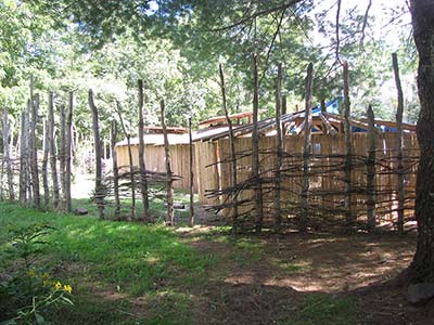
Between 1490 and 1530 AD, a small group of Native Americans settled along Wolf Creek in present-day Bland County. They built a circular palisaded village to house as many as 100 people. Excavation of the site in 1970 revealed 14 structures and a wealth of artifacts. The Wolf Creek Indian Village and Museum opened in 1998 to interpret the story of the region’s prehistoric peoples, including a full recreation of the village.
Crab Orchard Museum and Pioneer Park/Fort Witten
3663 Crab Orchard Road, Tazewell, Virginia
Website
Driving Directions
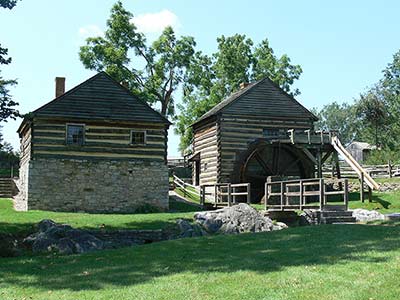
Crab Orchard Museum presents not only local history but a comprehensive overview of the Appalachian region, with important exhibits on early life, military history, and a natural history section documenting the animals of Southwest Virginia. The museum’s exhibit of Native American artifacts displays the results of excavations at the nearby Crab Orchard site, a large Woodland village. Pioneer Park village includes fourteen log structures that have been reassembled to show what daily life was once like in western Virginia.
Tazewell County Visitor Center
200 Sanders Lane, Bluefield, Virginia
Website
Driving Directions
Completed in 1896, the restored Sanders House is now home to the Tazewell County Visitors Center. The large Victorian house features oak woodwork, an original mural, and original Sanders family collections. The property also contains a granary, smokehouse and cottage outbuildings, as well as the relocated historic Bailey House, a pre-Civil War log structure that was home to one of Bluefield’s earliest families.
Wise County Historical Society Room
250 of the Wise County Courthouse, Wise, Virginia
Website
Driving Directions
The Wise County Historical Society maintains an office and bookstore open daily to assist family history researchers. They have an extensive collection of research materials.
Frontier Trail
Montgomery Museum/Lewis Miller Regional Art Center
300 South Pepper Street, Christiansburg, Virginia
Website
Driving Directions
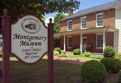
The town of Christiansburg was laid out around a central public square as the Montgomery County seat in 1790. Christiansburg’s Montgomery Museum houses a wealth of artifacts related to regional history and local artists, as well as family history research opportunities. The museum building was built around 1852 to serve as the Manse or minister’s residence for the Christiansburg Presbyterian Church. Ever-changing exhibits, presenting local artists, are displayed in the second-floor gallery. The museum shop features local history books, reproductions, and gifts.
St. Luke and Odd Fellows Hall and Visitor Center
203 Gilbert Street, Blacksburg, Virginia
Website
Driving Directions
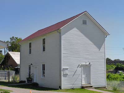
Slavery was on a smaller scale in western Virginia, and Montgomery County citizens were not overwhelmingly in favor of its continuation. Thousands of African-Americans, often shackled and chained together, traversed the Great Road through the vicinity in slave “coffles”on their way from auctions in the upper South, where tobacco culture was on the decline, to the Deep South. After the end of the Civil War, freed black communities and organizations were formed across the state. The Order of Odd Fellows and the Order of St. Luke joined forces in 1907 to build a community social center. It has been restored by the town of Blacksburg as a museum of African American culture and visitor center.
Smithfield Plantation Historic House Museum
1000 Smithfield Plantation Road Blacksburg, Virginia
Website
Driving Directions
Built about 1775 as the home of political and military leader William Preston, Smithfield is one of the oldest houses in Southwest Virginia. As surveyor of Montgomery County, Preston was in charge of the division of new lands to the west, including Kentucky. The house is furnished to represent the occupancy of the Preston family. The basement museum contains displays of historic objects and Native American artifacts from Montgomery County’s Shannon site, the most famous Woodland Period site in the Blacksburg area. A gift shop makes available reproduction artifacts, books, and colonial-era toys.
Glencoe Museum
600 Unruh Drive, Radford, Virginia
Website
Driving Directions
Glencoe, built in 1875, is the historic dwelling of Civil War General Gabriel Wharton and home of the Glencoe Museum and Gallery. The museum interprets the history of Southwest Virginia, highlighting the contributions of the Native Americans, early settlers, industries, educational institutions, businesses, local artisans and handicrafts, as well as topics of local interest. One of the most important collections on display is a group of Native American artifacts uncovered at Radford’s important prehistoric village, known as the Trigg site.
Wilderness Road Regional Museum
5240 Wilderness Road, Newbern, Virginia
Website
Driving Directions
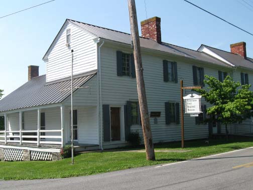
Newbern, established in 1810, contains a fine collection of frame and log buildings. Landowner Adam Hance recognized the economic benefits of developing a town along the Great Road, midway between Christiansburg and Evansham (now Wytheville). The building housing the museum is made up of two structures, an 1810 tavern and store and the 1816 Hance family home. The museum, owned and operated by the New River Historical Society, exhibits artifacts and documents highlighting life along the Wilderness Road.
Fort Chiswell House and McGavock Cemetery
325 Factory Outlet Dr., Max Meadows, Virginia
Website
Driving Directions
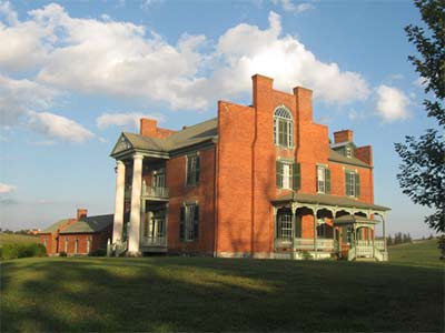
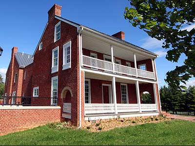
One of the most recognizable landmarks in Southwest Virginia, the house popularly known as Fort Chiswell Mansion was finished in 1840 for two brothers—Stephen McGavock (1807–1880) and Joseph Cloyd McGavock (1813–1886). The house has a fine Flemish bond facade, a two-story portico, unusual stepped gable parapets, and a fine staircase on the interior. Today, the Mansion at Fort Chiswell shares its rich history, promoting local and regional tourism, supporting educational programs, and contributing to the growth and success of local and regional artists. The walled McGavock Cemetery contains a rich collection of Germanic carved stones.
Haller-Gibboney Rock House and Thomas J. Boyd Museum
205 and 295 E. Tazewell Street, Wytheville, Virginia
Website
Driving Directions
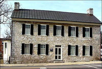
The town of Evansham, later named Wytheville, was established in 1790 as the seat of Wythe County, located on the Great Road. The Haller-Gibboney Rock House has played a significant role in Wytheville’s history since its construction in 1823. Original owner Dr. John Haller served his community as a country doctor, county coroner, and delegate to the Virginia Legislature. The house, together with the nearby Thomas J. Boyd Museum, exhibits original artifacts and period furnishings to interpret the settlement and development of the historic town. The exhibit includes objects uncovered in excavations at the nearby site of Fort Chiswell.
E. Lee Trinkle Visitor Center
975 Tazewell Street, Wytheville, Virginia
Website
Driving Directions
The E. Lee Trinkle Visitor Center is a great place to obtain information about cultural and recreational opportunities in the area. The Willowbrook Jackson/Umberger Homestead Museum next door helps visitors understand rural life in the region. A historic gas station, built by Herbert R. Umberger in 1926, embodies a later period of cross-country migration. Originally called the “Lakes to Florida Service Station,” the building contains a small museum that interprets early twentieth-century transportation along Rt. 23, then known as the Great Lakes to Florida Highway.
Carroll County Historical Society and Museum
515 North Main Street, Hillsville, Virginia
Website
Driving Directions
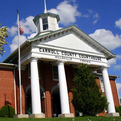
Hillsville was laid out in 1842 to serve as the seat of newly-founded Carroll County. The historic Carroll County Courthouse, home of the Carroll County Historical Society and Museum, presents the rich history of the county and its communities. Early Native American artifacts recovered from a nearby archaeological site are on display. The historic courthouse was the site of a famous courtroom shooting in March 1912.
Matthews Living History Farm Museum
496 White Pine Road, Galax, Virginia
Website
Driving Directions
Grayson County was settled in the mid-eighteenth century. The upper portions of the New River Valley were not easy to reach due to the difficult geography. The Grayson-Raleigh Turnpike, constructed in the 1850s, connected Grayson County with more distant markets. The Matthews Living History Museum was founded to preserve the cultural heritage of upper New River Valley farm life by presenting its artifacts, tools, equipment, methods and skills.
1908 Grayson County Courthouse Museum
107 E. Main Street, Independence, Virginia
Website
Driving Directions
The new town of Independence replaced the Grayson County seat at Greenville in 1850. Independence was laid out at the intersection of the main roads crossing the county from the north and east. The courthouse was built on a public square at one corner of the crossroads, across from a hotel and a store. The courthouse of 1908 has been restored and contains a museum of regional life and customs, a gift shop with regional crafts, and an auditorium used for concerts and plays.
Settlers Museum of Southwest Virginia
1322 Rocky Hollow Road, Atkins, Virginia
Website
Driving Directions
The Settler’s Museum, by means of a collection of historic buildings, presents the story of the different ethnic groups that migrated through and settled along the Great Road. The Visitor Center houses an exhibit entitled “The Migration Story” which explains the story of the Ulster-Scot and German migration up the Valley of Virginia.
Smyth County Historical Society and Museum
Main Street, Marion, Virginia
Website
Driving Directions
The Smyth County area was settled in the mid-eighteenth century and formed as a county in 1832. Thomas Hume’s land on the Middle Fork was selected as the site of a county seat, named in honor of Gen. Francis Marion of Revolutionary War fame. The museum offers a “tour through time” that interprets the economic and social development of rural Southwest Virginia with an impressive collection of artifacts from the prehistoric to the modern era.
Museum of the Middle Appalachians
123 Palmer Avenue, Saltville, Virginia
Website
Driving Directions
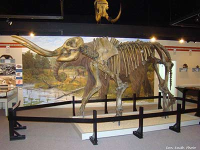
Gen. William Russell moved to the Salt Lick in 1788 and dug one of the first salt wells, marking the beginning of an important commercial mineral industry and company town. By the time of the Civil War, the salt works consisted of 38 furnaces boiling 2600 one-hundred-gallon kettles twenty-four hours a day. The Museum of the Middle Appalachians explores the long history of the region, in particular the attraction of prehistoric animals such as the woolly mammoth, as well as humans, to the rich deposits of minerals in Saltville.
Historical Society of Washington County
306 Depot Street, Abingdon, Virginia
Website
Driving Directions
Washington County was formed in 1776. The town of Abingdon has served as Washington County’s transportation, commercial, and political hub since it was laid out in 1778. Its location on the Great Road and later the Southwestern Turnpike brought prosperity. The Historical Society of Washington County is housed in the restored Abingdon Train Depot. The Society is available for genealogical and historical research, including local and regional history, published genealogies, and family histories.
Abingdon Muster Ground Interpretive Center
1780 Muster Place, Abingdon, Virginia
Website
Driving Directions
The northern trailhead for the Overmountain Victory National Historic Trail, the Abingdon Muster Ground is the regional center for American revolutionary period history. This is the place where local soldiers gathered to march to battle. Exhibits help visitors discover what life was like for the Overmountain men, backcountry women, African-Americans and Native Americans, as well as British Loyalists. The gift shop provides gifts, books, and historical reproductions.
The Great Road
George Washington’s Office Museum
Winchester Historic District, 32 West Cork Street, Winchester, Virginia
Website
Driving Directions
The unusual log and stone building known as Washington’s Office, one of Winchester’s oldest buildings, serves as a powerful symbol of Winchester’s connections with the French and Indian War. Strong local traditions affirm that the earliest section of the house was used as a survey office by George Washington between 1749 and 1752, and that he returned to use it as a headquarters during the building of nearby Fort Loudoun in 1756–7. The museum interprets the ten years that Washington spent in Winchester.
Museum of the Shenandoah Valley
901 Amherst Street, Winchester, Virginia
Website
Driving Directions
The story of this regional history museum complex begins with surveyor James Wood’s claiming of the site in 1735 and his founding of Winchester in 1744. Anchored by the Museum of the Shenandoah Valley which tells the story of art, history, and culture of the great Valley for which it is named, the site also features the Glen Burnie House, dating to 1794, and six acres of gardens established in the last half of the twentieth century by Wood descendant and Museum benefactor Julian Wood Glass Jr.
Newtown History Center
Stephens city historic district, 5408 Main Street, Stephens City, Virginia
Website
Driving Directions
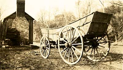
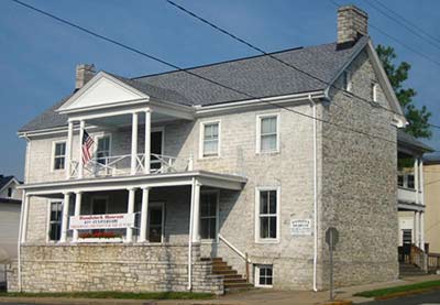
Stephens City, laid out in 1758, is the second oldest town in the Shenandoah Valley (after Winchester) and one of the best preserved of the “Valley Pike towns.” The Newtown wagon, manufactured at Stephens City, became legendary for its sturdiness among both Virginia farmers and settlers migrating to the far West, including the Gold Rush of 1849. The Newtown History Center, housed in the town’s earliest brick structure, interprets the history of the Great Road/Valley Pike and local manufacturing.
Belle Grove Plantation
336 Belle Grove Road, Middletown, Virginia
Website
Driving Directions
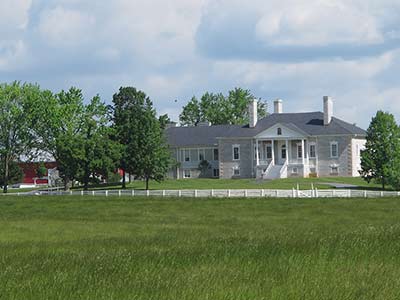
Belle Grove is the Lower Valley’s most architecturally distinguished building. The house was built in 1797 by a descendant of the area’s most prominent family of German origin. Builder Isaac Hite, Jr. (1758–1836) was a veteran of the American Revolution and the grandson of immigrant Jost Hite, partner in distribution of a vast land grant in the northern section of the Valley. The large, one-story limestone house is fronted by a temple-form porch supported by slender columns. The interior incorporates very fine Federal-style woodwork. The house museum includes an interpretive program and a gift shop.
Museum at the Edinburg Mill Edinburg visitor center
214 S. Main Street, Edinburg, Virginia
Website
Driving Directions
The Edinburg Mill, a three-story frame grist mill, stands on the banks of Stony Creek in the well-preserved turnpike town of Edinburg. Built about 1850, Edinburg is one of the best-preserved antebellum towns in the Shenandoah Valley. The mill is one of a series of grain, wool carding, and saw mills that were built after 1813 by Philip Grandstaff and his son George. Today it serves as a museum of the history of Edinburg, the Valley Pike, and the milling industry. It houses a visitor center and gift shop.
Woodstock Museum of Shenandoah County
104 S. Muhlenberg Street, Woodstock, Virginia
Website
Driving Directions
Shenandoah County was settled predominately by families of German stock. Woodstock was established in 1761 and was locally known as Muellerstadt. The Woodstock Museum is housed in the two-story, stone Marshall House, which served as the home of President James Madison’s father Thomas from 1772–1781. It contains a fine collection of local and regional artifacts, including tall case clocks by local craftsmen Jacob Fry and Caleb Davis. The nearby restored Courthouse Square is home to the 1775 stone Shenandoah County Courthouse, with its German Baroque-style cupola.
Strasburg Museum
440 E. King Street, Strasburg, Virginia
Website
Driving Directions
Strasburg, originally called Staufferstadt, was settled in the 1730s by mostly German-speaking families. It was the home for 150 years of a thriving pottery industry and was often referred to as Pot Town. Housed in a two-story brick factory built for a local pottery manufacturer in the late nineteenth century, the Strasburg Museum exhibits historical tools, furniture, Native American artifacts, and local pottery.
Hardesty-Higgins House/Valley Turnpike Museum
212 South Main Street, Harrisonburg, Virginia
Website
Driving Directions
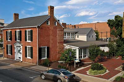
The land of Thomas and Sarah Harrison was selected in 1779 as the site for the seat of the new county of Rockingham. The town was provided with a central courthouse square, used as a model for towns across the nineteenth-century Midwest. The Hardesty-Higgins House, located directly on the route of the Great Wagon Road/Valley Turnpike, was begun by physician Henry Higgins in 1848. In addition to the Valley Turnpike Museum, which chronicles transportation through the Valley, it contains a visitor center, gift shop, and cafe.
Crossroads-Brethren-Mennonite Heritage Center
1921 Heritage Center Way, Harrisonburg, Virginia
Website
Driving Directions
Mennonites and Brethren have lived quietly in the Valley of Virginia for over two centuries. The Crossroads Heritage Center interprets their long history of faith, their unique farming traditions, their pacifism, and their legacy of craftsmanship to tourists and members of the Brethren and Mennonite communities. It incorporates an outdoor museum, including the relocated 1854 Burkholder-Myers House, home of an important Mennonite bishop, and the Whitmer School/Cove Mennonite Church, a one-room school house/meetinghouse.
Heritage Museum/Harrisonburg-Rockingham Historical Society
382 High Street, Dayton, Virginia
Website
Driving Directions
The town of Dayton grew up after 1828 along the Harrisonburg-Warm Springs Turnpike southwest of Harrisonburg. The main exhibit at the extensive Heritage Museum recounts Rockingham County’s history from the Native American period to the present. Exhibits include prehistoric artifacts, folk art, the local effects of national wars, and local economic and industrial history. The society also provides an extensive research library and a wide variety of local genealogical books for sale in the gift shop.
Daniel Harrison House
335 Main Street, Dayton, Virginia
Website
Driving Directions
Daniel Harrison (1701–1770) moved from Delaware to Rockingham County about 1738. Daniel Harrison is thought to have built the house in 1749 and operated a grist mill, distillery, and general store at the site. The house was expanded and the windows enlarged before the Civil War. The restored house is open to the public on weekends during the warm months.
R. R. Smith Center of History and Art
22 South New Street, Staunton, Virginia
Website
Driving Directions
Many of the settlers to the Augusta County area were Scots-Irish. A small village grew up around the county’s first log courthouse, built in 1745. The newly named town of Staunton was laid out in thirteen half-acre lots in 1749. The R. R. Smith Center is housed in the former Eakleton Hotel of 1893. In addition to the offices of the Historic Staunton Foundation and the Staunton Augusta Art Center, it is the home of the Augusta County Historical Society history gallery and library, an excellent place to begin local family research.
Frontier Culture Museum
1290 Richmond Avenue, Staunton, Virginia
Website
Driving Directions
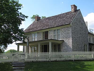
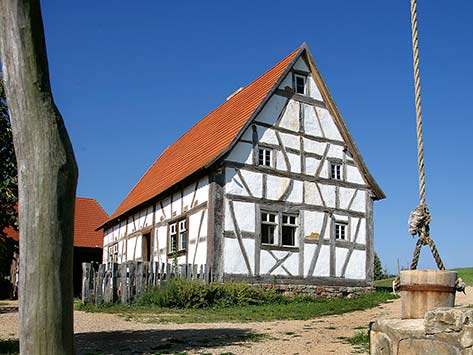
The Frontier Culture Museum is an outdoor living history exhibition of farmsteads, each of which represents one of the ethnic traditions that formed the way of life in the Valley of Virginia. Carefully reconstructed farm complexes, including houses, barns, and outbuildings from England, Ireland, Germany, Africa, and Virginia are inhabited each day by interpreters who demonstrate farming, cooking, and other domestic activities.
Crossroads
Cyrus McCormick Farm and Workshop
128 McCormick’s Farm Circle, Raphine, Virginia
Website
Driving Directions
The museum at the Cyrus McCormick Farm and Workshop provides an opportunity for visitors to understand how traditional farming around the world was revolutionized by the inventions of a Scots-Irish family of farmers and innovators. Walnut Grove, the McCormick family farm near Steele’s Tavern, is the birthplace of the mechanical reaper, the ancestor of the modern combine harvester.
Rockbridge Historical Society/Campbell House
101 East Washington Street, Lexington, Virginia
Website
Driving Directions
The Rockbridge Historical Society maintains three historic buildings in downtown Lexington. The most significant is the Campbell House, which houses the society’s collections. The museum is open for regular hours and admission is free. The Campbell House includes significant local furniture and artifacts of interest to family researchers.
Natural Bridge and Monacan Village
15 Appledore Lane, Natural Bridge, Virginia
Website
Driving Directions
The dramatic 200-foot tall and 90-foot wide limestone arch over Cedar Creek was acquired by Thomas Jefferson in 1774 as a public trust to ensure protection and access. Together with Niagara Falls, Natural Bridge was ranked as the continent’s most impressive natural landmark in the eighteenth and early nineteenth centuries. Today the site is served by a complex of Colonial Revival buildings, including a large hotel. The Monacan Indian Nation of Virginia has joined with Natural Bridge to present a Native American Village complex at the site, staffed by living history guides in reproduction work shelters and houses.
Blue Ridge Parkway Visitor Center
Milepost 115 on the Blue Ridge Parkway, Roanoke, Virginia
Website
Driving Directions
The Blue Ridge Parkway Visitor Center serves as a gateway to the spectacularly beautiful scenic highway that runs along the crest of the Blue Ridge through Virginia and North Carolina. The landscaped parkway was founded in 1935 and completed by public works organizations during the Great Depression. It is lined with sites depicting local history. Visitors will find information about the Parkway and the Roanoke Valley and enjoy a shop featuring gifts and Parkway memorabilia. There is also access to a series of scenic trails.
History Museum of Western Virginia
1 Market Street SE, Roanoke, Virginia
Website
Driving Directions
The Roanoke History Museum is located in Roanoke’s lively and historic Market Square. The museum’s main exhibit, entitled Crossroads of History, interprets 10,000 years of western Virginia’s heritage through artifacts that span the entire history of the region. Among the nearly 6,000 items in the Museum’s collection are Native American arrowheads, pottery, and a rare example of “Rawrenoke” beads (from which the city derived its name).
Salem Museum and Historical Society/Williams Building
801 East Main Street, Salem, Virginia
Website
Driving Directions
William C. Williams, the builder of the first Roanoke County Courthouse, constructed this unusual brick home and store in Salem in 1845. The building was relocated and restored in 1992 to serve as a museum containing local Indian artifacts and mementos of daily life from across the span of Salem’s history. The Museum Shop features books, crafts, replicas, educational toys, and more.
Botetourt County Historical Society and Museum
Courthouse Square, 1 Main Street, Building 3, Fincastle, Virginia
Website
Driving Directions
Fincastle was one of the first communities in the original area of Botetourt County, founded in 1772. The town is an outdoor museum of late eighteenth- and early nineteenth-century American architecture. The Cumberland Gap Road (Fincastle Turnpike) was authorized to run between Fincastle and the Kentucky line in 1831. The museum building, located in Court House Square, was erected circa 1800. It serves as a repository for hundreds of artifacts that interpret the history of the county.
